A “trog”?
A “klog”?
Let’s go with klog.
Here’s my klog of a trek I took, from Loděnice (about 15 km west of Prague) south through the Český kras (a wooded area), past Karlštejn castle, to the village of Zadní Třebaň.
When I lived in Plzeň in 1991-92, I discovered that the country has a network of walking trails throughout the rural areas, with accompanying maps. As Plzeň is a rail hub with lines heading out in (I think) six directions, it was easy to find a route where you went out by one train line, walked 10 or 20 miles, then came back by another.
I’d been eyeing this route since I’d bought the relevant map back in early September. The weather lately has been gorgeous, and I didn’t have any scheduled obligations today, so I took the opportunity.
The journey started at Smíchov nádraží (the railway station in the Smíchov neighborhood southwest of downtown Prague).

After a delay due to some sort of track problem, I was at Loděnice about 15 minutes after I expected to be.

My first set of sign posts, and my first landmark is—a cementárna, or cement works.

Yup, there’s the cement works.

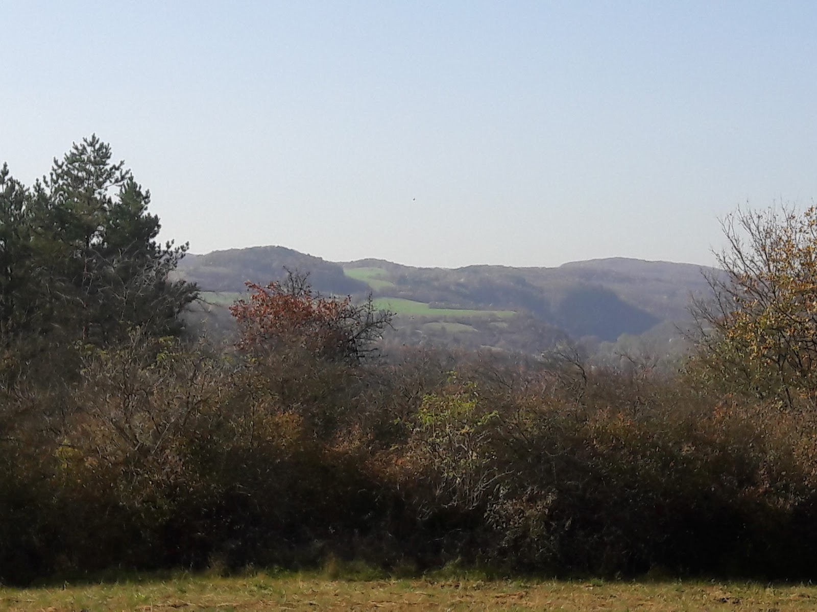
But eventually you leave the road behind and rise up to vistas of classic Czech countryside—usually nothing dramatic, just rolling hills, with human settlement tucked into the valleys.

Part of the trail goes through the Karlštejn National Nature Preserve, which is described on the lower sign as “the heart of the Czech karst.”

At this same spot I see that I’ve walked 3.5 km from where I got off the train in Loděnice (actually, it was a bit more, because I missed a turn and had to double back), and that I have 7 km ahead of me to Karlštejn.


Leaving the blue trail behind, joining the red, 6 km left to Karlštejn. And the trail signs also start mentioning the Bubovice waterfalls (Bubovické vodopády).

Just up the hill you reach the edge of a zone that is being left without any active management, to study how the forest evolves on its own. As you can see from the sign in Czech, English, and German, there’s a danger of trees falling on you.

The implication seems to be that in the parts of the forest that are more conventionally managed, there is no such danger, as if they were on the lookout for trees that might fall and get to them before they can do anybody any harm. I doubt that’s true.
An information board about Doutnáč, “a forest left to spontaneous development.”

After leaving the edge of the nonintervention zone, I at last come to the Bubovice stream, which turns out to be a line of mud crisscrossed by foot bridges.

I am not optimistic about the Bubovice waterfalls.
A little further on some water is visible, though not enough that you can see it moving.

Still not optimistic.
Hey, whole pools of water!

I can actually hear a trickle of water! (You can’t see it in this picture, but the naked eye can discern droplets falling from the exposed rock into the pool below.)


A whole set of pools! Like a cascade of them! Wait a minute …

Yup, this is the Bubovické waterfalls. Maybe I’ll try to come back on a nice spring day after several days of rain.
But there is a cool-looking mouth of a cave nearby.

This is as far in as I went.

Next to the “waterfall” someone thought it was important to post a quote from Robert Fulghum: “We can lose our lives in various ways. Death is only one of the possibilities.”

Much of the path I was on was marked as an “educational path,” which means that at intervals you encounter information boards telling you about the natural history of the area you’re in. This one includes a salamander, so I had to take a shot for our friend Stan.


A meadow under a cliff, with some sort of sleeping structure perhaps?

Now 3.5 km from Karlštejn.

Just up the hill from this junction I see my first walkers since I’d started, over two hours earlier. The wife says something to the husband in sounds I know well. “Good morning,” I say to her in English.
“Good morning.”
“That sounds like an American accent.” And it is. They’re from Maine. Their youngest child is a teacher in England. He has break next week and will be meeting up with them in Nuremburg, but the parents came over early to visit friends in Prague. They’ve been seeing city sites during the evenings but getting out of the city during the days training for hiking they’ll be doing in Austria.
A kilometer on is the royal spring, supposedly encountered by Charles IV during hunting outings from his newly built castle of Karlštejn. And because the area around the well has no agriculture leaching chemicals into the groundwater, the well water supposedly meets all public-health standards.

Except there was hardly any water visible.
Well, I’d brought my own anyway.
This juncture was where I encountered the only other walkers on the “deep woods” part of the trek, a group of 7 people in upper middle age (like me), but Czech (not like me).
And also next to the spring was this picture of former Czech president Václav Havel, posted about 10 feet up a tree.

I’m having trouble translating the text at the bottom. Google Translate renders it as, “Václav Havel deserved freedom and democracy,” but it’s more like he “served the cause of” freedom and democracy. And the really small writing at the bottom suggests that Parliament passed a resolution to that effect in 2012, a year after Havel’s death.
About another kilometer further on, the highest tower of Karlštejn peeks over the crest of a field.

With the brain’s ability to shut out what doesn’t matter, it looks more like this:

I’m now at the Oak of the Seven Brothers, and a kilometer from the castle.

The tree is a so-called “památný strom,” or memorial tree, a tree that is marked out for its particular size, form, or link to historical events.

According to stories, seven thief-brothers divided up their loot under this tree. According to other legends, the tree reaches back to Charles IV [who reigned in the second half of the 1300’s]. But it’s not that old; it’s age is estimated at 350 years.”(People are very eager to connect things to Charles IV.)
The tree. According to the sign, near the end of its life, despite being cared for.

And then geology. This sign describes a nearby spot where you can see an unusually clear demarcation between the underlying gray, bioclastic rock and the overlying dark shale, from a more biologically impaired era, a transition that happened in the comparatively short time span of a few hundred thousand years in the Middle Devonian.

And here’s the rock itself. You can see the darker shale on the left, a little bit underneath the bioclastic rock, even though the shale is newer. This land got seriously squeezed.

300 meters to the castle, and a person biking down a path marked, “No bikes.”

The various towers of the castle start to be visible through the partially deleafed trees.

Another sign for the educational path, describing how the local environment was changed by the construction of Karlštejn, with some clearing done for defensive purposes, and more done to provision the castle. Also, “The habit of throwing waste from the castle area over the castle walls persists from the Middle Ages through today.”

And just to the left of the sign, a few pieces of modern litter, tossed off the path near the castle entrance.

Turning around, the castle entrance is just visible through the trees, with the castle’s high tower looming above.


The castle is flying the flags of the Czech Republic and the European Union. For now—elections are this Friday and Saturday, and people are wondering how many votes the anti-EU parties will get.

Continuing on past the castle entrance, you encounter the predictable assortment of tourist souvenirs.
You can get these same items from any tourist street in

Just down the road, a wax museum with figures from Czech history, and the restaurant “Charles IV”—that dude is in everything.

The castle from the northeast.

Having walked a little further, I’m now at the southeast corner.

And my last junction. I’ve come 10.5 km, and it’s another 3 km to the train station in Zadní Třebaň.

A pair of sturdy horses pulls a load of turists up from the Karlštejn train station.

Five minutes up a rise, and I am treated to this view:

A couple is sitting on a picnic blanket enjoying the view as well, and I impose upon them to get my picture taken.

Down the other side of the rise, and Karlštejn is gone from sight, but there is still the rolling Czech countryside.

The village has some impressive Baroque-style gates at the entrances to the courtyards of what were once farms.


A man pulling a trailer full of harvested grasses, presumably for an animal he’s keeping.

This bridge takes me across the Berounka.

Those white dots are swans—trust me.

And right at the other end of the bridge, the Zadní Třebaň train station.

13.5 km, about 8.4 miles. Home by just after 3pm. A beautiful day out.
Hang on. There is a sign warning you about some potentially fatal hazard? Seems rather Un-Czech.
ReplyDeleteYes, but note that you have to walk a few miles into the woods to encounter that sign.
DeleteSo all in all, they're doing a good job of keeping you safe from warnings of hazards.
This comment has been removed by the author.
ReplyDeleteThanks for the Klog!
ReplyDeleteEspecially the salamander part!
ReplyDeleteYou're welcome! (Always good to know your audience.)
DeleteThank you
ReplyDelete